


Details
Object ID 000204
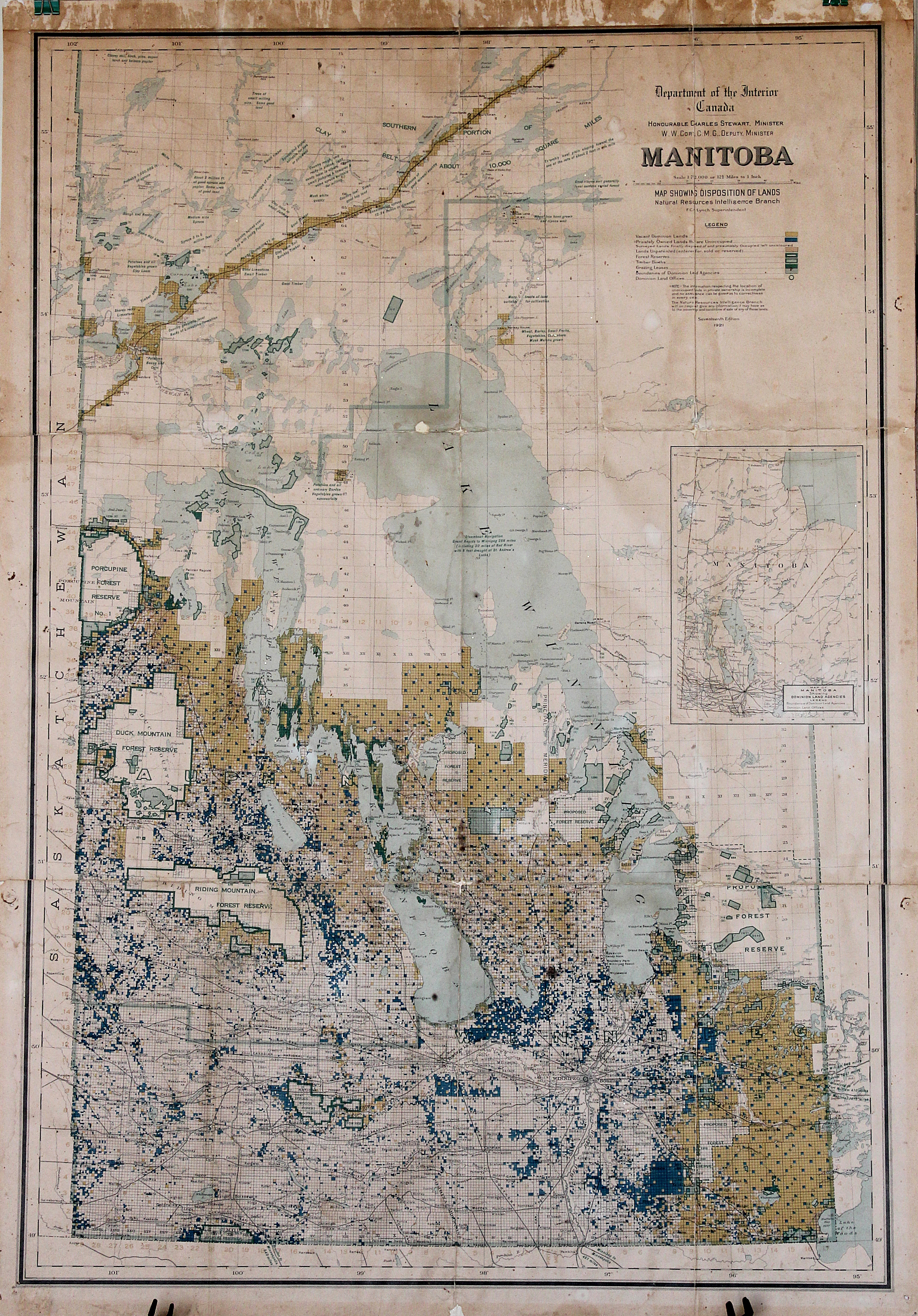
Object Name Map of Manitoba, 1921
Object Desc Department of the Interior Canada map, showing disposition of lands from 1921- Manitoba.
Collection General Collection
Accession # 0000.0331
Alternate ID
General Category Maps
Category Maps: Canada
Source Max Matietz
Source Category Gift
Accession Date AUG 2,2011
Credit/Acknowledgement
Location Temporary
Object Date 1921
Start Year Range
End Year Range
Status On Exhibit
Object Keywords
Images
 (click for full image)
Image Caption
Description
Conditions
Events
Date AUG 2,2011
Summary Status change
Notes Status changed to On Exhibit from On Exhibit - automatic entry by admin
Date AUG 2,2011
Summary Location change
Notes Location changed to Station/WaitingArea/SouthWall from Station/WaitingArea/SouthWall - automatic entry by admin
Date JUL 4,2014
Summary Location change
Notes Location changed to St/Office/SWall from St/WaitingRm/SWall - automatic entry by admin
Date AUG 18,2015
Summary Location change
Notes Location changed to Temporary from St/Office/SWall - automatic entry by admin